
Windslab Wed Mar 25
Quick reportadamrodrigues11 · Mar 26, 2026 · Birkenhead
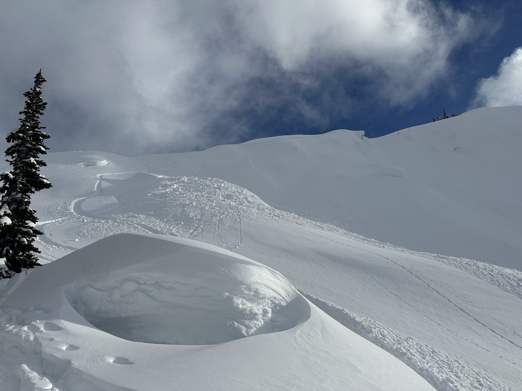
Avalanche
- Run Length
- 100
- Slab Width
- 40
- Trigger Type
- skier
- Wind Exposure
- leeSlope
- Avalanche Size
- 2
- Slab Thickness
- 40
- Trigger Sub Type
- accidental
- Start Zone Aspect
- N
- Vegetation Cover
- openSlope
- Start Zone Incline
- 35
- Avalanche Character
- windSlab
- Number Of Avalanches
- 2-5
- Start Zone Elevation
- 1920
- Runout Zone Elevation
- 1820
- Weak Layer Burial Date
- 2026-03-24
- Start Zone Elevation Band
- tln
- Avalanche Occurrence Datetime
- 2026-03-26T01:30:00.000Z
Crown depth ranged from 30-50cm. A second size 1 avalanche (< 5m x 30cm crown) was triggered by the toe of the debris of the size 2, releasing on a convexity about 100m down the slope.
Incident
- Group Size
- 3
- Group Activity
- skiing
- Number Involved
- 1
- Number Caught Only
- 1
- Snow Depth Trigger Point
- variable
- Terrain Shape Trigger Point
- convex
Late report after a week of skiing in the Phelix Creek area. A poor decision was made to ski a short but steep and convex slope with signs of wind loading less than 24h after the Mar 24 storm. We had become confident in the bond of the new storm snow below ridge crest throughout the day, but the terrain in the immediate lee of the ridge no more than 50m from our previous drop in points was far more reactive. A sobering reminder to not become too complacent as conditions can vary greatly over even small distances. The trigger point was about 10m from the skiers right of the crown line (ranging from 30-50cm deep), with about 30m propagation to the left (over the steeper more convex slope). Skier was caught and carried about 10m but was not buried and able to ride out unharmed. The debris from the left side of the avalanche travelled much farther down the slope (~100m) and then triggered a much smaller (~5m wide, 30cm crown) storm slab on another convexity and that ran for another 40m or so. Also noteworthy - the start zone pretty much reloaded within 24h due to winds overnight and made the crown much less noticeable. We did not return to investigate the weak layer, but based on crown depth and snowfall totals we assume it was older storm snow.