
Below threshold?
Quick reportahnice · Nov 7, 2024 · North Rockies
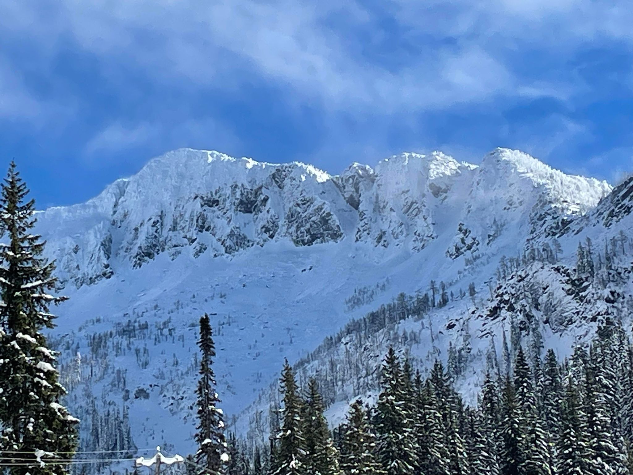
Quick report
- Weather
- cloudy, sunny, warm
- Ride Type
- cutBlocks, openTrees, sunnySlopes
- Stayed Away
- alpineSlopes
- Riding Quality
- ok
- Snow Conditions
- powder
- Avalanche Conditions
- avalancheConditionTemp
The sharks are lurking and will bite if you try to feed them. Stay clear of anything that looks like it might have teeth and keep it mellow. The alders are on the hunt to make new friends as well. Light-footed skiing highly recommended. Overall surprisingly decent turns (considering the low snow depth). Temps were rising around lunchtime. We assumed it’d be unlikely to observe any avalanche activity due to the snowpack being below threshold - but if you find a deep pocket, your search shall end. We spotted several natural avalanches that started near ridge top.
Weather
- Avg Temp
- -1
- Max Temp
- 1
- Min Temp
- -7
- Wind Speed
- windSpeedCalm
- Blowing Snow
- light
- Sky Condition
- brokenClouds
- Wind Direction
- SE
- New Snow24 Hours
- 3
- Storm Start Date
- 2024-11-01
- Temperature Trend
- rising
- Precipitation Type
- none
Blowing snow observed at ridge top on NW aspect (around 12:30pm from the parking lot).
Snowpack
- Depth
- 52
- Obs Type
- summary
- Site Aspect
- NE
- Site Elevation
- 2000
- Foot Penetration
- 35
- Site Elevation Band
- tln
- Surface Conditions
- newSnow, surfaceHoar, variable
Early season snowpack. Surface hoar up to 3mm at lower elevations (and a mix of PP 1-2mm, PPsd 2-3mm and isolated SH fragments at 2000m observed). Snowdepth variable between 37cm at lower elevation to 52cm at Summit.
Avalanche
- Run Length
- 150
- Slab Width
- 20
- Trigger Type
- natural
- Wind Exposure
- leeSlope
- Avalanche Size
- 2.5
- Slab Thickness
- 30
- Start Zone Aspect
- NW
- Vegetation Cover
- openSlope
- Start Zone Incline
- 40
- Avalanche Character
- stormSlab
- Number Of Avalanches
- 2-5
- Start Zone Elevation
- 2300
- Runout Zone Elevation
- 2150
- Avalanche Observation
- moreThan48hrsAgo
- Start Zone Elevation Band
- tln
- Avalanche Occurrence Datetime
- 2024-11-05T10:00:00.000Z
Avalanches were only visible briefly and the lighting made it challenging to see the starting zone. Recorded wind speeds on Southridge were light over the last few days, so we suspect avalanches started sliding within recent storm snow (15cm on 11/04) with some wind loading near ridge top on NW aspect.