
Hotlum Glacier
Quick reportTheodore Balboni · Jul 4, 2026 · Mount Shasta
Quick report
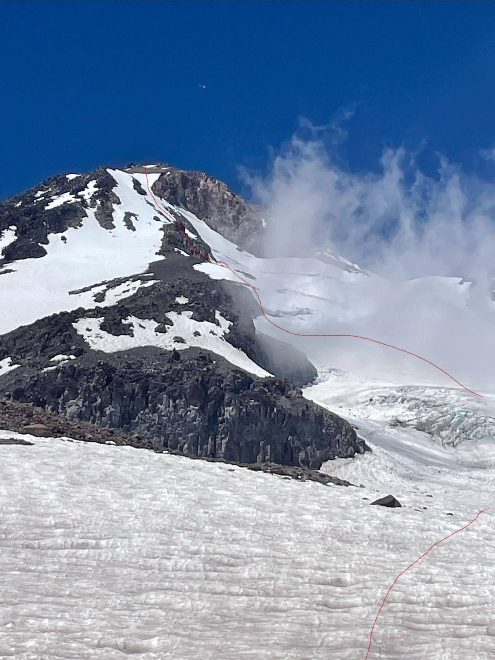
My partner and I set out to climb the Hotlum Glacier on July 3, 2026. We stepped off from the Brewer Creek parking lot around 1000. Mt. Shasta has many years when this trailhead is not clear of snow until much later in the season, making the combination of a shorter approach and cold upper-mountain conditions a challenging one. Our approach took 2.5 hours. We followed the Brewer Creek Trail for the first mile or so of established trail, then continued on a fainter climbing trail for a little over half a mile. We arrived at the base of a moraine complex below the Hotlum Glacier, possibly a terminal or recessional moraine, at approximately 8,800 feet. We encountered our first snow on this moraine and decided to work climber’s right around the shoulder, continuing upward in the direction of the Hotlum Glacier. This line led us directly to the established Hotlum base camp at approximately 10,100 feet. The Hotlum base camp has a small unidentified stream with glacial runoff. The camp is generally free of snow in the summer, includes approximately six bivouac structures, and has a large snowfield above it suitable for practicing crevasse rescue systems. We set camp, practiced crevasse rescue systems, cooked dinner, and went to bed around 1730. At 0130 we woke up, and at 0230 we stepped off for the climb, roped up and wearing crampons. It took us about 30 minutes of snow travel before we reached the glacier proper. Air temperatures on the glacier were about 38°F overnight, and we were concerned about being on the glacier once it received direct sun. Over the next few hours, we navigated around or over approximately nine crevasses before reaching the lowest climber’s-left exit at about 13,200 feet, around 0500. The bergschrund had limited viable exit points, but we found a snow bridge that held. At approximately 13,275 feet, just above the bergschrund, we climbed a steep section of snow using our ice tools and gained a small cluster of volcanic rock. Once on the rock, we put away the rope. The snow did not appear adequate for ice-screw protection. We had two pickets, which would have been a better option for snow protection, but we decided not to pitch out the chute. The chutes we climbed were relatively narrow, with decent rock by Mt. Shasta standards on either side. It struck me that the best protection for the conditions that day would likely have been a small alpine rock rack with a few cams and nuts, but we had not come prepared to protect rock. Over the next few hours, we weaved in and out of rock bands and steep snow. We probably climbed the chute about 35 percent on rock and the remainder on snow. The steepest snow sections were approximately 55 degrees. Finally, at about 13,800 feet, we exited the snow and the technical portion of the ascent onto a talus-and-scree plain. From there we hiked quickly to the summit and arrived on the summit block at 0800. On the descent, we started on skier’s left of the Wintun Glacier and descended the glacier to approximately 12,700 feet. We then entered the snowfield and talus field between the Wintun and Hotlum Glaciers and continued descending and traversing back toward Hotlum base camp, arriving at camp at 1040. We were back at the car at 1300 and made it back into the town of Mt. Shasta at 1430. *The photo included shows our general ascent in broad strokes. It should not be relied upon for technical navigation through the glacier or the left snow/ice chute.