
Sky Pilot Moraines - A Big Na!
Quick reportpaul.c.mcbride · Mar 13, 2024 · Sky Pilot


Quick report
- Weather
- cloudy, sunny, warm
- Ride Type
- mellowSlopes, openTrees
- Stayed Away
- alpineSlopes, convexSlopes, steepSlopes, sunnySlopes
- Riding Quality
- good
- Snow Conditions
- deepPowder, heavy, wet
- Avalanche Conditions
- avalancheConditionSlab, avalancheConditionSnow, avalancheConditionTemp
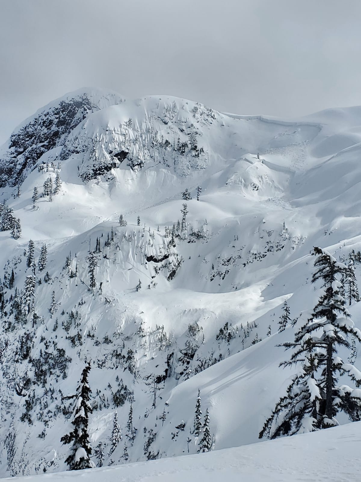
Fun day avalanche viewing on day 3 of a big mountain decision making and ski mountaineering course with Holly Walker (Fall Line Guides). 280cm crown down to basal facets across the ridge above the moraine. Big one! Broken skies with a couple of convective flurries with In-N-Out Sun. Fun quality heavy pow above 1300m, getting extremely isothermal and concrete-like on the ski out by 2pm.
Weather
- Avg Temp
- -2
- Max Temp
- -2
- Min Temp
- -6
- Wind Speed
- windSpeedLight
- Blowing Snow
- none
- Sky Condition
- brokenClouds
- Snowfall Rate
- 1
- Wind Direction
- SW
- New Snow24 Hours
- 0
- Storm Start Date
- 2024-03-09
- Temperature Trend
- rising
Broken skies with a few convective flurries, when the sun came out in full the temperature increase was very strong.
Snowpack
- Depth
- 440
- Obs Type
- point
- Site Aspect
- NW
- Test Fracture
- resistant
- Site Elevation
- 1540
- Ski Penetration
- 20
- Test Initiation
- none
- Foot Penetration
- 70
- Site Elevation Band
- tln
- Surface Conditions
- newSnow
- Test Failure Layer Crystal Types
- surfaceHoar
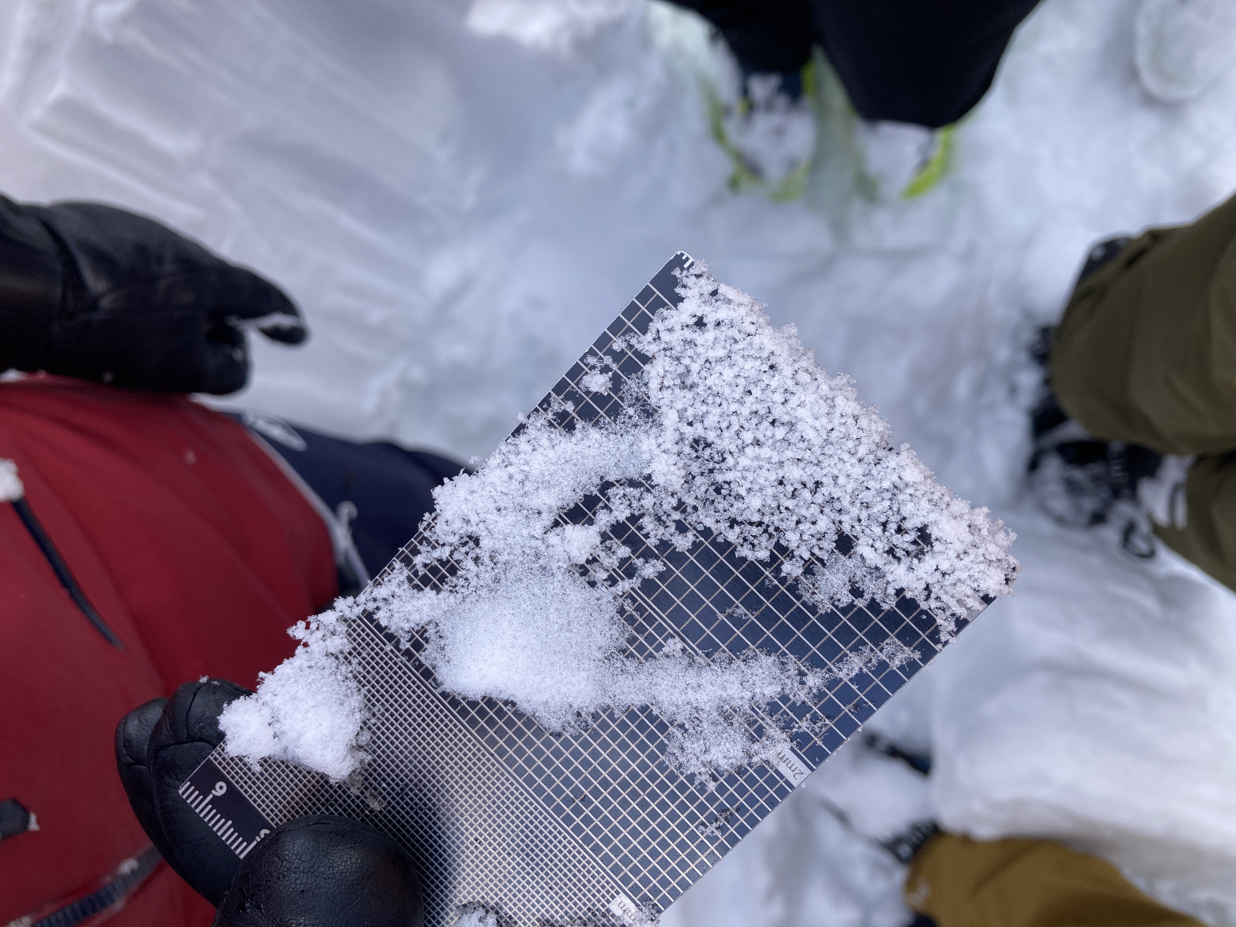
CT did not produce results in a N facing windloaded test slope feature, so snow depths are likely deeper here than measured in other locations on open slopes. Propagation Saw Test also no results, although it was tough to find the problem layer on start. We isolated a column and slid the shovel down the back side to see if we could get any of the more recent layers to pop off - we found some DF particles down 10cm all the way to a graupel layer that must have occured sometime during the March 9-11 storm cycle. Surface Hoar layer observed from March 8 laying flat, down 145cm which was the problem layer we were most interested in investigating. Temperature gradient very low (-0.1) between layers which to us indicated a healing snowpack. Will be interesting to see the next Na cycle with the extreme warming coming up! Hold on to yer horses!
Avalanche
- Run Length
- 320
- Slab Width
- 200
- Trigger Type
- natural
- Wind Exposure
- crossLoadedSlope
- Avalanche Size
- 3.5
- Slab Thickness
- 280
- Start Zone Aspect
- W
- Start Zone Incline
- 35
- Avalanche Character
- deepPersistentSlab, stormSlab
- Number Of Avalanches
- 2-5
- Start Zone Elevation
- 1670
- Runout Zone Elevation
- 1350
- Avalanche Observation
- 12to24hrsAgo
- Weak Layer Crystal Type
- facets
- Start Zone Elevation Band
- alp
- Avalanche Occurrence Datetime
- 2024-03-13T19:00:00.000Z
We suspect this avalanche released in the afternoon of March 12, certainly sometime in the 48 hours prior. The slab released down to basal facets with a depth of 280cm (thanks to some beta from a nearby guided operation). The start zone is near 1670m, the avalanche ran through highly complex terrain and apparently triggered other deep persistant slabs on connected convex slope angles. It ran past the entry to Cleavage and over the frozen waterfall and across the main skintrack that crosses beneath Stadium Gully. The extent was visible on the uptrack through the trees lookers right of the gullies coming off of Stadium and was jawdropping.