
Could it be (another) size 5?
Quick reportcdnmoose11 · Mar 29, 2026
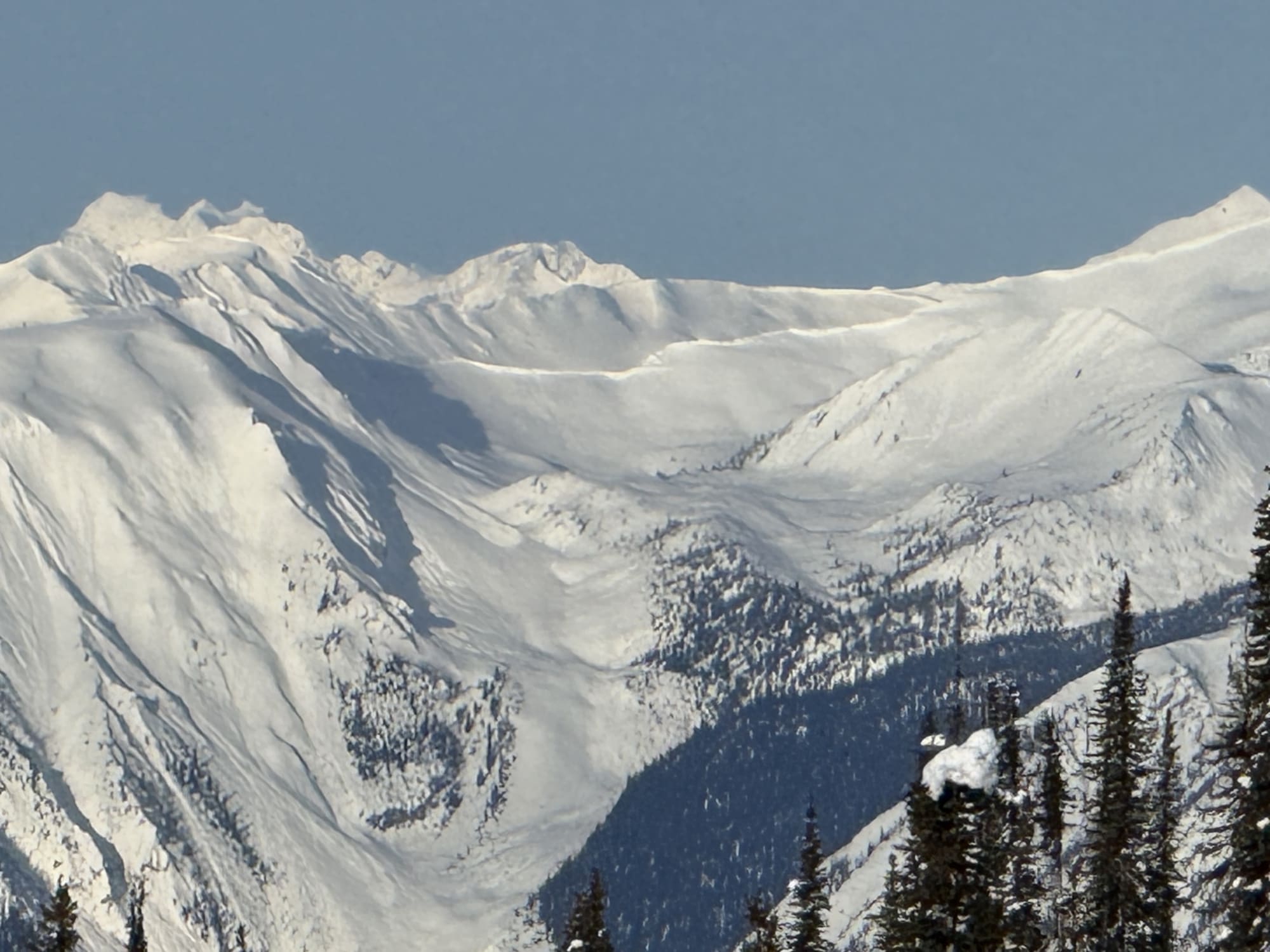
Quick report
See 'Avalanche' tab for details and mass calculations. Mt Rowley is approximately 46 km NNW of Golden, BC, and immediately east of Kinbasket reservoir.
Avalanche
- Slab Width
- 1300
- Trigger Type
- natural
- Wind Exposure
- leeSlope
- Avalanche Size
- 5
- Slab Thickness
- 200
- Start Zone Aspect
- E
- Vegetation Cover
- openSlope
- Avalanche Character
- persistentSlab
- Number Of Avalanches
- 1
- Avalanche Observation
- 12to24hrsAgo
- Start Zone Elevation Band
- alp
- Avalanche Occurrence Datetime
- 2026-03-20T15:59:00.000Z
LARGE AVALANCHE ON MT ROWLEY: LIKELY FROM THE MARCH 17-20th, 2026 ATMOSPHERIC RIVER Observed Monday March 23rd @ 0900hrs. Posting for historical reasons (and apologies for the delay - out of range at Campbell Icefield Chalet). Avalanche seen from outside the front door of the lodge: 23 km away as the crow flies, measured on CalTopo. Numbers below taken from Google Earth estimates based on the attached photo. Width: 1300m Crown: 2m (estimate - if you can see a crown clearly defined from 23km away, I'd guess it's at least 2m high... but it may be 3m +) Distance: estimate 200m average (range 100-300m). Could not see debris piles from the chalet. ==================== Mass: 1300m x 2m x 200m x 200 kg/m3 (conservative average snow density) = 104 million kg (~115,000 tons). Size 5 avalanche defined as greater than 100,000 tons. ***