
Kootenay Pass
Quick reporthuckleberry · Apr 15, 2026 · Kootenay Pass
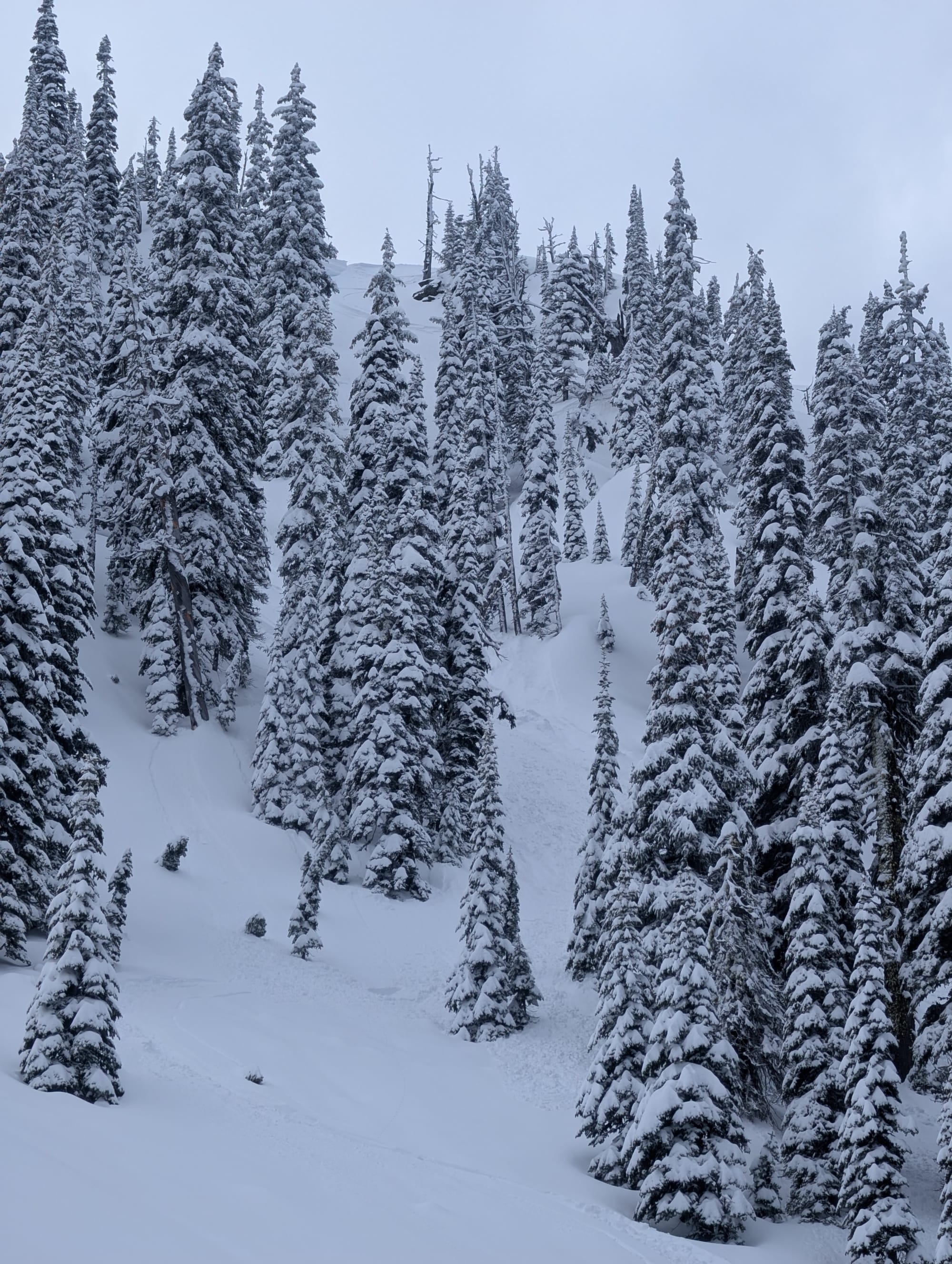
Quick report
- Weather
- cloudy, stormy, sunny
- Ride Type
- denseTrees, mellowSlopes, openTrees, steepSlopes, sunnySlopes
- Stayed Away
- alpineSlopes, convexSlopes, steepSlopes
- Riding Quality
- amazing
- Snow Conditions
- powder
- Avalanche Conditions
- avalancheConditionSlab, avalancheConditionSnow, avalancheConditionSound
Excellent skiing! Didn't feel the crust under the storm snow on N, NE, E, or SW slopes from 2200-1900m. Whumpfing and limited shooting cracks observed while breaking trail on uptracks, mostly in flatter terrain.
Weather
- Avg Temp
- -3
- Wind Speed
- windSpeedLight
- Blowing Snow
- light
- Sky Condition
- brokenClouds
- Snowfall Rate
- 1
- Wind Direction
- SW
- New Snow24 Hours
- 25
- Storm Start Date
- 2026-04-14
- Temperature Trend
- steady
- Precipitation Type
- snow
Snowpack
- Obs Type
- summary
- Site Aspect
- N, NE
- Site Elevation
- 2100
- Ski Penetration
- 25
- Foot Penetration
- 35
- Cracking Observed
- 1
- Test Failure Depth
- 35
- Site Elevation Band
- tln
- Surface Conditions
- newSnow
- Whumpfing Observed
- 1
- Test Failure Layer Crystal Types
- crust
Avalanche
- Run Length
- 100
- Slab Width
- 8
- Trigger Type
- skier
- Wind Exposure
- leeSlope
- Avalanche Size
- 1
- Slab Thickness
- 35
- Trigger Sub Type
- intentional
- Start Zone Aspect
- N
- Vegetation Cover
- sparseTrees
- Start Zone Incline
- 40
- Avalanche Character
- stormSlab, windSlab
- Crust Near Weak Layer
- 1
- Number Of Avalanches
- 2-5
- Start Zone Elevation
- 2080
- Runout Zone Elevation
- 2000
- Weak Layer Burial Date
- 2026-04-14
- Start Zone Elevation Band
- tln
- Avalanche Occurrence Datetime
- 2026-04-15T19:00:00.000Z
Storm slab triggered on the second ski cut at the top of the ridge. Storm snow observed to be 30-40cms at ridge line on North aspects. I was expecting more of a sluff to start moving but the slab propagated ~3-4m on either side of me. Easily skied to my safe zone. Also observed several small (<5m) slabs release on NE, E, and NW aspects between 2200-1900m where the storm snow had consolidated a bit (sun or wind affected).